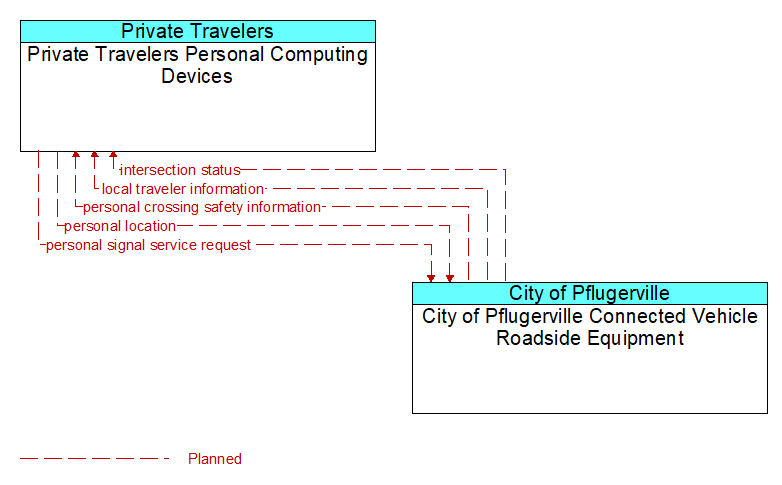
Interface: Private Travelers Personal Computing Devices - City of Pflugerville Connected Vehicle Roadside Equipment
Architecture Flow Definitions
intersection status (Planned) Applicable ITS Standards
Current signal phase and timing information for all lanes at a signalized intersection. This flow identifies active lanes and lanes that are being stopped and specifies the length of time that the current state will persist for each lane. It also identifies signal priority and preemption status and pedestrian crossing status information where applicable.
local traveler information (Planned) Applicable ITS Standards
Traveler information including traffic, road, and weather conditions for a particular locality. This flow includes the location-specific traveler information and time effectivity of the information.
personal crossing safety information (Planned) Applicable ITS Standards
Current crossing status including permission to cross, crossing time remaining, and warnings in the event that a vehicle reports an imminent intersection infringement that may impact non-motorized users including pedestrians and cyclists.
personal location (Planned) Applicable ITS Standards
The current location (latitude, longitude, and elevation) reported by the personal information device
personal signal service request (Planned) Applicable ITS Standards
A request for right of way from a personal device that indicates the type of traveler (pedestrian, special needs pedestrian, bicyclist, etc.), anticipated time of arrival, travel path, and crossing duration.